Topography & architectural surveys
Thanks to our technical training and expertise, we are competent to carry out many topographical services meeting the needs of a diverse clientele: individuals, contractors, owners, real estate professionals, infrastructure managers, etc.
Terrestrial and bathymetric surveys
Terrestrial surveys allow us to draw up plans on which is represented the topography of the ground and its natural or artificial details. Bathymetric surveys deal with the mapping of watercourses. We carry out these surveys using topographic measurement devices, automated or not, such as electronic tacheometers, 3D scanners, GPS, etc.
Georeferencing (GPS)
Georeferencing allows to precisely locate a point or a marker in three dimensions, using signals from satellites captured by a ground receiver. The accuracy of latitudes and longitudes obtained is within a centimeter. We use the TERIA network, established by our profession, to georeference daily hundreds of points.
Level surveying
We are also competent to define the elevation of a point (or a set of points, i.e. contour lines) using specific measuring tools. This service called level surveying is based on a local reference point to suit the requirements of each project, or according to a reference system known as the Nivellement Général de la France (NGF) to define, for instance, the limits of flood zones.
As-built drawings
During and after the construction of networks and infrastructures (drainage systems, power lines, and other utilities) as-built drawings consist of surveying the position of the surface, underground and underwater networks, their nature and exact 3D position. Chartered land surveyors then feed these surveys into the databases of public utility providers. These will be used, for example, to identify and reposition the networks in the event of subsequent works carried out nearby. Providers respond to intervention requests based on such drawings.
Building plans
We provide different types of plans:
Interior plans
Interior plans are essential to selling, leasing, joint-ownership or the management of buildings and premises.Architectural plans
To meet the needs of contractors and developers, we draw up more detailed interior plans that are essential to the partial or total rehabilitation of a building. We record many details: load-bearing walls, sanitation or heating systems, door swing direction, allocation of premises, supply and drainage columns, etc.Facade plans
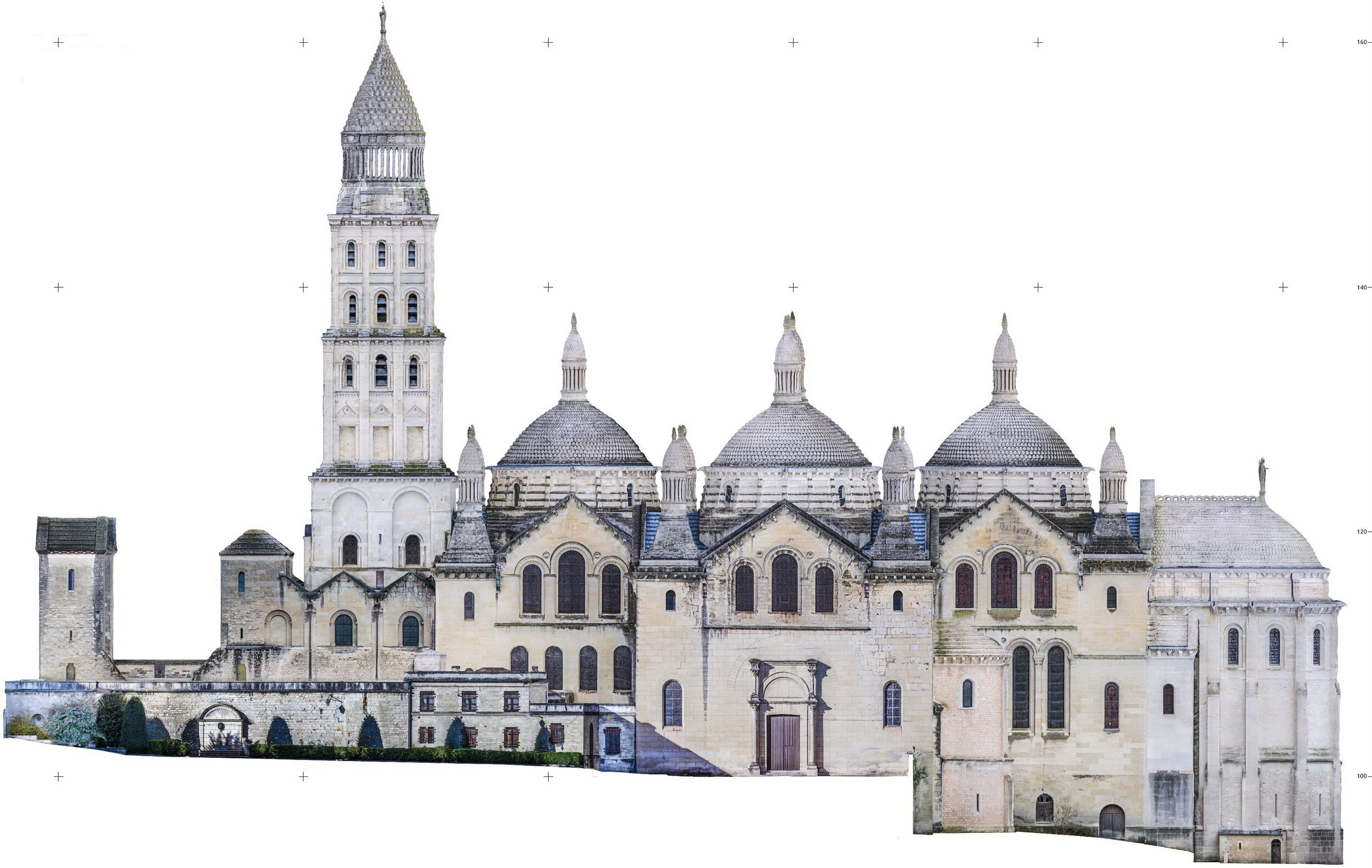
A facade plan contains the precise location of all the elements (openings, roofings, acroters, string courses, etc.) to be taken into account for projects such as the restoration of a building.Wall diagrams
These diagrams are required for construction studies on a dividing line or the calculation of quotas of common ownership.


